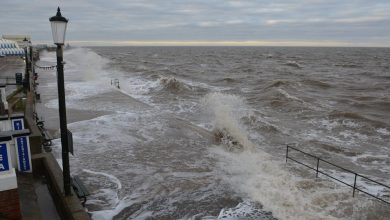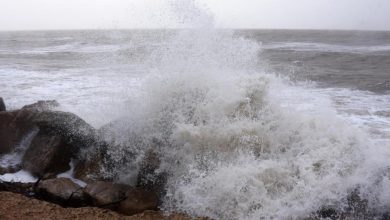
Norfolk is under a yellow alert for heavy rain and strong winds as Storm Babet approaches. The storm is expected to bring flooding, power cuts, and travel disruption to the area. Coastal residents and visitors are advised to take extra caution. The storm will begin in the south and west before moving east.
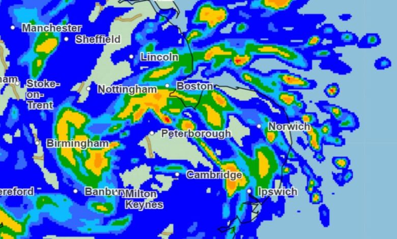
On Thursday, Norfolk will see scattered showers, some of which may be heavy and thundery in coastal areas. It will be rather cloudy with the possibility of some bright or sunny spells. Temperatures will peak at 18°C and fall to 13°C overnight. The majority of the rain will be concentrated around the coast.
Friday will see showers that last longer and are heavier than on Thursday. It will also be windier, with gusts reaching 42mph in Cromer. Temperatures will range from a high of 14°C to a low of 11°C. The rain will be far heavier and more widespread compared to Thursday.
Saturday will still see some rain, but it will be less heavy than on Friday. Temperatures will peak at 13°C and fall to 9°C. Coastal areas will experience gusts of wind up to 28mph.
By Sunday, conditions will improve with brighter and drier weather expected. The winds will also ease off, and there may be some cloud coverage in the morning that should clear by the early afternoon.
Overall, Norfolk can expect heavy rain, strong winds, and potential flooding and travel disruption from Storm Babet. It is important for coastal residents and visitors to exercise caution during this time.